


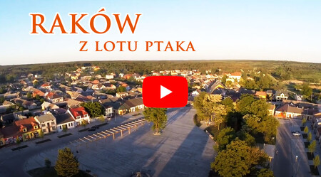
Basic information
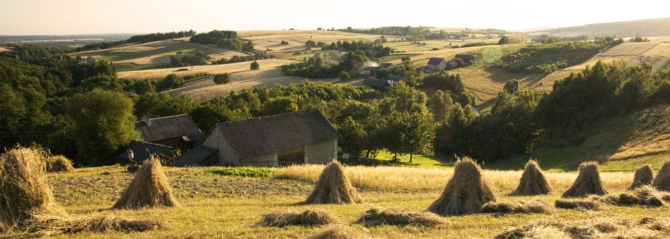
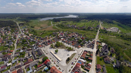
The Raków Commune ( the administrative district) is located in the Kielce County, the Świętokrzyskie Voivodeship, in south-central Poland. It covers an area of about 73.78 square miles (191,087 km2) whence 42% is the agricultural land and 54% is the forest. The Raków commune in 2010 had a population of 5987. The administrative district comprises of 28 villages including Raków, which is the largest and it is the seat of the Local Goverment. The administrative district area is the part of two mesoregions: The Szydłowski Foothills and The Świętokrzyskie Mountains. Across the central part of the Raków commune flows the Czarna (Black) River.
Two hiking trails run through the area of the Raków commune:
• the yellow tourist route (Szydłów - Widełki),
• the blue tourist route (Chęciny - Łagów, named: E. Padechowicz).
The total length of these routes is slightly over 31 km (of which the yellow trail is 27.7 km, the blue route is 3.4 km).
The area of the Raków commune is dominated by small agricultural farms. Their productions are cross-curricular, but grains, potatoes and strawberries are dominant. The main directions of yhe development are agri-food processing and tourism, which make the use of the natural resources. The Gmina Raków's advantages are a good state of the natural environment, charming places, which are the ideal localization for resorts and retirement homes.
Geology
The Raków commune covers parts of wide geological history of The Świętokrzyske Mountains: the Orłowiński Landscape Park and the Ociesęcki Landscape Park in the north part of the commune. They consist of paleozoic formations, mainly cambrian sandstones and mudstones. Ordovician, silurian and devonian formations occur locally as well. In Bardo (one of the Raków commune's villages) are diabases, which are the proof that volcanic processes took place in the Paleozoic Period. In this place the bardolit mineral (before the unknown mineral, which belongs to chlorites) was discovered. The highest peak in the commune is Góra Zamkowa (the Castle Mountain) 422 metres (about 1384,51 ft). River valleys and ravines were mainly formed in tectonic fractures or were carved into eroded rocks (eg. shale).
The southern part of the Gmina Raków is located within the area of the Szydłowski Foothills, has tertiary (mainly limestone) deposits in the ground that cover quaternary deposits. The Czarna River and its tributaries caused the fragmentation of the Foothills through the gouging of deep valleys with a flat bottom and steep slopes of up to 15 m height. The remainders of Pleistocene glaciations are sheets of boulder clay, sand(rivers, gravel, dunes), and loess soil. The youngest sediments occur in the valley of rivers - fluwisoles, sands and peat (near Raków). Quaternary deposits occupy the largest part of the commune's area. In the sedimentary rocks you can find many interesting fossils such as trilobites, graptolites, mussels, brachiopods and many more.
Protected natural areas
Within the Raków commune's area there is the Cisowsko-Orłowinski Landscape Park (established in 1995). The park is located within the Kielce Highland and includes the eastern part of the Świętokrzyskie Mountains. The area of the Park is crossed by the following ranges: Orłowiński, Cisowski, Ociesęcki and Bardzański Hills. The greatest value of the natural environment is the plant cover, especially forests. Forests are characterized by significant typological diversity of habitats, species composition of tree stands and their age structure. There are 13 forest habitat types from dry conifer to alder. A large diversity of habitats is accompanied by a wealth of plant groups, both the forest vegetation (15 groups, among which dominated by mixed upland forests, forests and fresh forests and mixed forests) and peat bogs. It covers the north-eastern part of the commune on the border with the districts of Daleszyce and Łagów.
The second protected area in the commune is the Cisowsko-Orłowiński Protected Landscape Area, which was created in 2001 in the area of the Cisowsko-Orłowiński Landscape Park's zone. It covers agricultural and forest areas. There are 10 natural monuments and 2 nature and landscape complexes in its area. A valuable element is the historic urban layouts of Łagów, Raków, Daleszyce and Dębno.
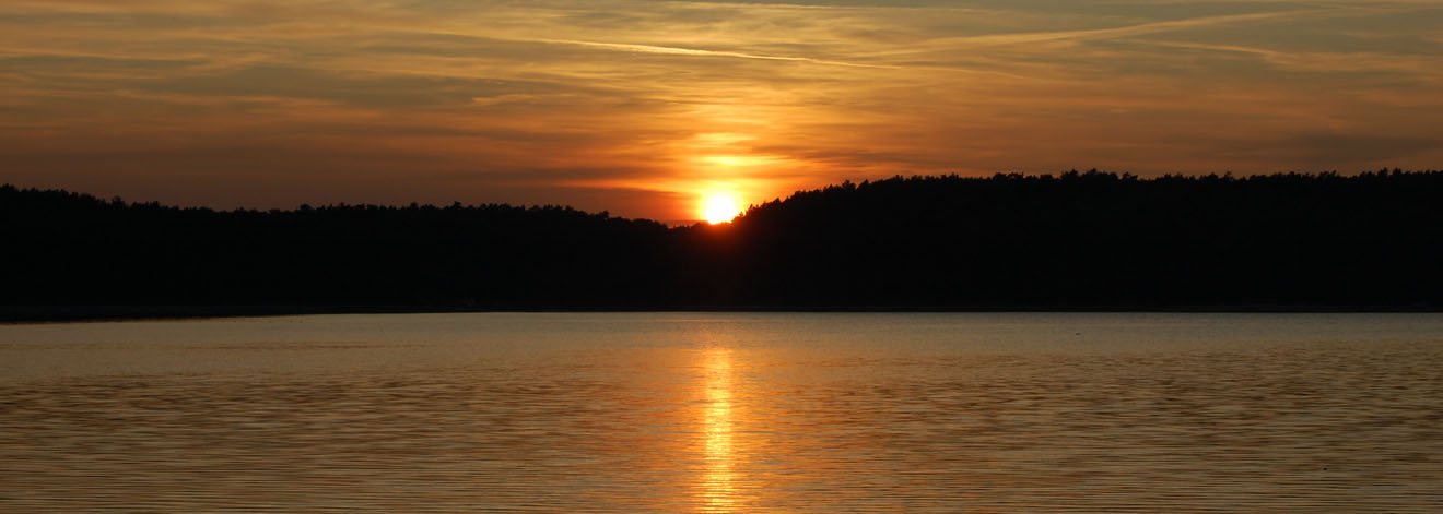
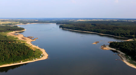
The third protected area located in the commune is The Chmielnicko-Szydłowski Protected Landscape Area. It is generally located in the central part of the Świętokrzyskie Voivodeship. The area belongs to the communes of Gnojno and Szydłów, and partly also to the following communes: Morawica, Pierzchnica, Kije, Chmielnik, Raków, Łagów , Busko Zdrój, Stopnica and Tuczępy. It is an area of the agricultural and forestry character. In terms of habitat, pine forests and mixed coniferous forests prevail here, sporadically there are the fragments of reed, alder and riparian forests. An important element of the vegetation are non-forest communities: mainly bogs with the participation of such rare plants as: the white beak-sedge, the blue moor-grass, the Davall sedge, orchids: the marsh helleborine,the western marsh orchid. The outcrops of carbonate rocks are overgrown with xerothermic grasslands, but much poorer than the lower Nida River. Numerous ponds and the Chańcza reservoir create biotopes for many species of water-swamp birds.
Fauna
At the Raków commune's territory there are 29 species of birds listed in Annex I of the Council Directive 79/409 / EEC of April 2, 1979 on the conservation of wild birds, as well as 11 species of regularly occurring migratory birds not mentioned in the aforementioned annex.
Among mammals, there are species of a wild boar, a deer, a roe deer, and among the small animals 3 species are listed in Annex II of Council Directive 92/43/EEC of 21 May 1992 on the conservation of natural habitats and wild fauna and flora: an European beaver, an European otter and a greater mouse-eared bat. In addition, there are 5 other species of bats: a serotine bat, a Daubenton's bat, a Leisler's bat, a common noctule and a brown long-eared bat. Other important species of mammals present in this area are badgers, edible dormouses and hazel dormouses.
Among the reptiles, the occurrence of Slowworms, sand lizards, viviparous lizards, grass snakes and common European adders has been reported. Two of the amphibians species found here are listed in Annex II to the abovementioned Council Directive. They are the northern crested newts and the European fire-bellied toads. There are other species of amphibians here: a smooth newt, an alpine newt, a common toad and an European tree frog.
Among invertebrates, 7 species from Annex II occur in the Cisowsko-Orłowińskie Forests. They are: a shellfish (bivalvia) -a thick shelled river mussel; dragonflies (odonate) - a green snaketail and a large white-faced darter, and butterflies - a scarce large blue, a large copper, a violet copper and a marsh fritillary.
The world of fish was artificially enriched as a result of the construction of the Chańcza Reservoir. In the commune there are among others: a burbot, a grayling, a roach, a bream, an European carp ,a ruffe, a perch, a pike. In the area of The Nature 2000 Cisowsko-Orłowińskie Forests, there were found 2 species of lamprey: a brook lamprey and a Ukrainian brook lamprey.
Ensembles and historical objects
In the Raków commune there are nine historic buildings or complexes entered into the register of monuments under the Act of 15 February 1962 for the protection of the cultural property and museums.
They are:
- The parish church under the invocation of the Visitation of the Blessed Virgin Mary complex with the church cemetery in Bardo, reg. No. A.451 / 1-2 from 20.01.2010. Built in 1789; founded by Barbara Misiewska; on the antepedium of the main altar there is the Misiewscy - Ciołek coat of arms.
- The filial church of St. Andrew in Drogowle, 1620-30, the registration number: A.452 from 20.01.2010.
- The urban layout and the small-town housing complex with relics of sacred and the bourgeois architecture of the Polish Brethren in Raków, 2nd half of the 16th century - 1st half of the 17th century and 19th / 20th century, reg. No. A.453 from 20/01/2010.
- The parish church of the Holy Trinity complex in Raków (3 Kościelna Street), including the parish church of the Holy Trinity, 1640-50, 1947; the belfry from the 1st half of the 18th century; the former presbytery (now a pilgrim's house), XVI / XVII century, reg. No. A.454 / 1-3 from 20.01.2010. Built between 1640 and 1950 from the foundation of the Cracow Bishop. The church was built on the site of the destroyed Arian congregation. Inside, late-Baroque style equipment.
- The reformed church, currently under the invocation of the Saint Anna in Raków, 1641, 18th century, reg. No. A.455 from 20.01.2010. Built in 1641, rebuilt in the middle of the 18th century.
- The city council building in Raków, named "the Arian House" or " the Mayor House", 9 Jan Sienieński Street, XVI / XVII century, re no .: A456 from 20.01.2010
- The remains of a fortified castle with a moat in Rembów, 14th century, reg. no. A.457 from 20.01.2010.
- The manor complex in Rembów comprising the manor (remnants, currently a dwelling house) and the park remnants, XVII century, reg. Number: A.458 / 1-2 from 20.01.2010.
- The parish church of St. Stanislav Bishop and Martyr in Szumsko, 1673, 1910, 1945-50, reg. no.: A.459 from 20.01.2010.
In the Raków commune there are also a number of historic buildings intended for the inclusion in the commune record of monuments. These are:
BARDO
• The Roman Catholic parish cemetery; 2nd half XIX century
CHAŃCZA
• The chapel of the Holy Mother, brick-built; XIX century
DĘBNO
• The urban layout; XVIII century
• The chapel complex of St. Tekla comprising:
• The chapel, brick-built (rock-solid); 2nd half XVIII century
• The fence with a gate, brick-built; 2nd half XVIII century
DROGOWLE
• The church cemetery as a part of the Filial Church complex of St. Andrew; after 1620.
• The manor house complex comprising:
• the manor house ruins, brick-built; 3rd quarter of the 19th century
• the farm building; 3rd quarter of the 19th century
• the park remains
KORZENNO
• The chapel of the Holy Mother, brick-built; XIX century (the renovation)
MĘDRÓW
• The chapel, brick-built; 1895
NOWA HUTA
• The war cemetery of German soldiers; 1944 - 1945 (in the grove in the village of Podgórze)
• The war cemetery of German soldiers; 1944 - 1945 (two places), (according to the information obtained from the Raków Commune Office, based on the interviews with the residents, the graves were exhumed several years ago and moved to a different location, a more accurate location is not possible)
OCIESĘKI
• The church cemetery; after 1617.
• The Roman Catholic parish cemetery; before 1878 (the area within the fence)
RAKÓW
• The parish church complex of St. Trinity including:
• The church cemetery; after 1640 (the area within the fence)
• The fence witha gate, brick-built; XVII century and XIX century, the renovation in the 20th century
• The presbytery, brick-built; around 1920.
• The Reformat Church complex, currently fillial of St. Anna comprising:
• The church cemetery
• The fence of the church cemetery, brick-built; 2nd half XVII century
• The Roman Catholic parish cemetery; before 1831 (thearea within the fence)
• The Arian cemetery; 1st half XVII century
• The Jewish cemetery; 2nd half XVIII century
• The Arian House, 2 Jan Sienieński Street (currently "Arianka Bar"), brick-built; XVI / XVII century, rebuilt in the 20th century, cellars preserved
• The Arian House, 6 Jan Sienieński Street, brick-built; XVII century, rebuilt
• The ground-floor buildings, the market and the adjacent streets, brick-built; XIX and XX centuries, destroyed in 1944, rebuilt in the traditional forms using old walls.
SZUMSKO
• The parish church complex of. St. Stanislav Bishop and Martyr including:
• The belfry, brick-built; 1751
• The church cemetery; after 1637 (the area within the fence)
• The fence, brick-built; XIX century
• The presbytery, brick-built; 1845, expanded in 1927.
• The burial cemetery complex comprising:
• The Roman Catholic parish cemetery; before 1857 (the area within the fence)
• The chapel, brick-built; XIX / XX century
• The remains of a manor house complex including:
• The stable, brick-built; 2nd half of XIX century rebuilt
• The granary, brick-built; 20s of the 20th century (currently the front part is partially ruined).


 Zadanie dofinansowane ze środków WFOŚiGW w Kielcach w wysokości